Democratic Republic of the Congo


Assessments
March 2026
Planting of rice (north), maize (north/second) and yams is underway. Cassava (south) and maize (south/second) are in growth stage. Mixed rainfall patterns have been characterizing the last three dekads. Kwilu, accounting for 10.6% of the national cereal production, received 15% below the long-term average rainfall. In the south, above-average precipitation (+17%) is recorded in Haut-Katanga. Biomass remains below average in Haut-Katanga, Kwilu and Lualaba, where 30%, 25% and 60% of the active cropland is in poor vegetation status, respectively. According to UNHCR, more than 33,000 Congolese refugees spontaneously returned from Burundi to eastern DRC within a month following the reopening of the Burundi–DRC border on 23 February, with many arriving to find their homes destroyed and belongings looted. Initial assessments in Uvira and Fizi show families arriving with few belongings and in urgent need of shelter, basic household items, health care, and access to water and sanitation.
Hotspots Time Series
Assessment_graph
Country Summary
Statistics
Date
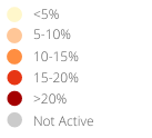
Agricultural cover
Number of administrative units classified as Warning (%)
Warnings and indicator graphs
Date
Cover
Date
Cover
WI_graph1
Date
Cover
WI_graph2
Date
Cover
Indicator
WI_graph3
Indicator temporal profile (ASAP units level 1)
Year
Cover
Indicator
Area
ASAP1 Units
Indicator maps
Main indicators at dekad
Last 6 dekads for indicator
Date
Indicator
Date
Indicator

Date
Indicator
Date
Indicator
Date
Indicator

Date
Indicator
Ancillary Information
Overview maps
Phenology
Layer
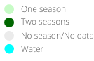
Season progress
Dekad
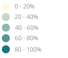
Agricultural area
Cover
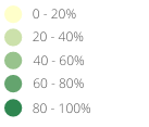
Warning frequency map
Cover
ASAP units
Crop calendar and Production
Selection of FAO crop calendars matching with ASAP phenology
CCP_graph1
Agriculture statistics: ten crops with largest area
CCP_graph2
Agriculture statistics: ten crops with largest production
CCP_graph3
Share of national cereal production by subnational units
CCP_graph4
For additional information related to agriculture and drougth monitoring visit also: