Algeria


Assessments
June 2024
At the end of the winter season, the country still shows a separation between the western and the eastern half in terms of seasonal rainfall performance, with the western part affected by early season drought and with the central and eastern parts benefitting from more continuous rainfall distribution. Pastoral areas in the western part, but also in the inland areas are also negatively affected by drought.
Hotspots Time Series
Assessment_graph
Country Summary
Statistics
Date
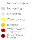
Agricultural cover
Number of administrative units classified as Warning (%)
Warnings and indicator graphs
Date
Cover
Date
Cover
WI_graph1
Date
Cover
WI_graph2
Date
Cover
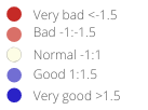
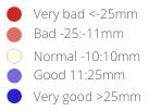
Indicator
WI_graph3
Indicator temporal profile (ASAP units level 1)
Date
Cover
Indicator
Area
ASAP1 Units
Indicator maps
Main indicators at dekad
Last 6 dekads for indicator
Date
Indicator
Date
Indicator

Date
Indicator
Date
Indicator
Date
Indicator

Date
Indicator
Ancillary Information
Overview maps
Phenology
Layer
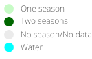
Season progress
Dekad
Agricultural area
Cover
Warning frequency map
Cover
ASAP units
Crop calendar and Production
Selection of FAO crop calendars matching with ASAP phenology
CCP_graph1
Agriculture statistics: ten crops with largest area
CCP_graph2
Agriculture statistics: ten crops with largest production
CCP_graph3
Share of national cereal production by subnational units
CCP_graph4