Benin


Assessments
September 2026
The first-season maize harvest is currently underway in the southern parts of the country and is expected to finish by the end of September. Overall prospects remain average, sustained by generally favourable, near-average cumulative rainfall during crop development. Simultaneously, planting for the second-season maize is progressing in the south under average rainfall conditions, with completion also anticipated by late September. In contrast, the northern provinces have experienced highly irregular rainfall distribution. The region suffered significant moisture deficits at the start of the season in April (with cumulative rainfall roughly 40% to 65% below-average) and again between late June and mid-July (falling 30% to 50% below average). As a result, particularly poor crop and rangeland biomass conditions are evident across northern departments. In Borgou province, specifically, nearly 55% of the active crop area is affected by a greenness anomaly. The provinces of Alibori, Atakora, and Donga are similarly impacted, though to a lesser extent, with 30% to 35% of their active crop areas exhibiting vegetation stress. Persistent insecurity further exacerbates these poor northern crop and rangeland conditions. According to the WFP (Benin Country Brief, August 2026), the resurgence of armed incidents linked to the Sahel crisis continues to worsen Benin's humanitarian situation. This instability primarily impacts the Atacora, Alibori, and Borgou departments, which are currently hosting internally displaced persons alongside refugees and asylum seekers from Burkina Faso, Niger, Togo, and Nigeria.
Hotspots Time Series
Assessment_graph
Country Summary
Statistics
Date
Agricultural cover
Number of administrative units classified as Warning (%)
Warnings and indicator graphs
Date
Cover

Date
Cover
WI_graph1
Date
Cover
WI_graph2
Date
Cover
Indicator
WI_graph3
Indicator temporal profile (ASAP units level 1)
Year
Cover
Indicator
Area
ASAP1 Units
Indicator maps
Main indicators at dekad
Last 6 dekads for indicator
Date
Indicator
Date
Indicator

Date
Indicator
Date
Indicator
Date
Indicator

Date
Indicator
Ancillary Information
Overview maps
Phenology
Layer
Season progress
Dekad
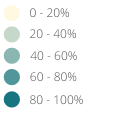
Agricultural area
Cover
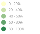
Warning frequency map
Cover
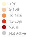
ASAP units
Crop calendar and Production
Selection of FAO crop calendars matching with ASAP phenology
CCP_graph1
Agriculture statistics: ten crops with largest area
CCP_graph2
Agriculture statistics: ten crops with largest production
CCP_graph3
Share of national cereal production by subnational units
CCP_graph4
For additional information related to agriculture and drougth monitoring visit also: